THE DESIGN FOR TRAFFIC ENVIRONMENT
In addition to his own lane and direction information, the pilot needs
information about the traffic surrounding him. This information encompasses
the quantity of lanes, layers, their capacities, distance indication
to other aircars and a head-up map of proximity traffic (rear mirror).
|
|
|
|
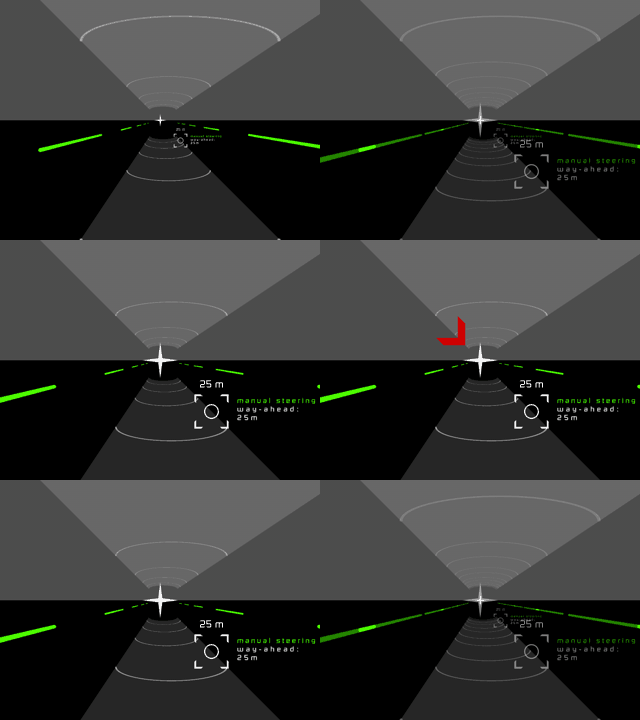
A deviation indicator:
Placed in the center of the display it indicates the pilot's absolute
position in relation to the virtual path.
The note on the right shows the pilot's actual maneuver mode (manual
steering, flight-by-wire mode, auto-pilot) and the length of the pilot's
visual way ahead.
The red arrow appears when the pilot is getting off his path.
|
|
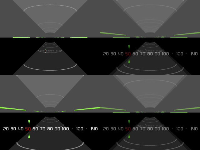
Speed meter:
At the bottom of the display. Shows the aircar's speed and the current
speed limit. A second speed limit sign above the deviation indicator
shows the speed limit of a new chosen lane.
|
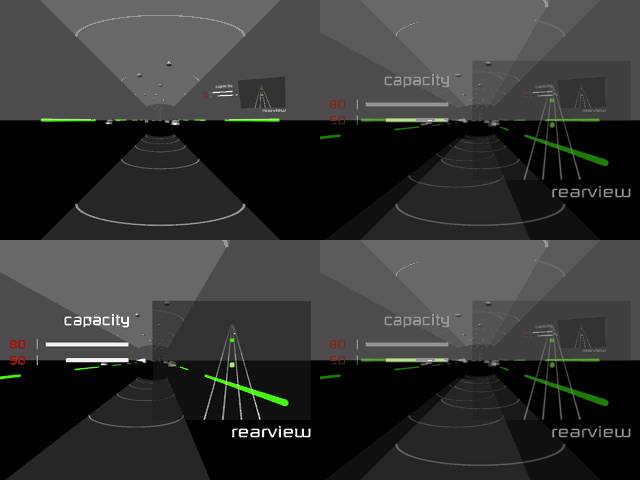 |
Right-side traffic head-up map:
Shows proximity traffic, the amount of lanes and the present position
of the aircar.
Right-side capacity indicator:
Shows the quantity of lanes and their capacities.
|
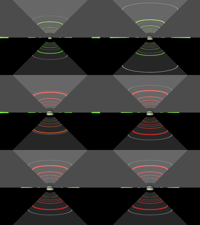 |
Proximity warning:
If two aircars get too close on the lane, this is indicated by red blinking
arrows.
In addition the car ahead pushes the stripes closer to you while they
change their color from green to red.
|
|
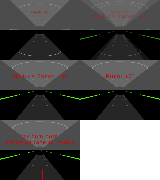
Warnings:
- Reduce Speed
- Aircars ahead
- Pitched way ahead
|
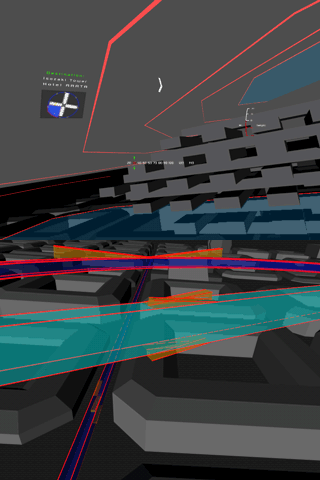 |
Blue Zones:
While traveling outside the Airways and Skyways, the pilot needs to
recognize the position of the lanes and layers. This mode is called
Blue Zone, similar to a low speed traffic area.
|
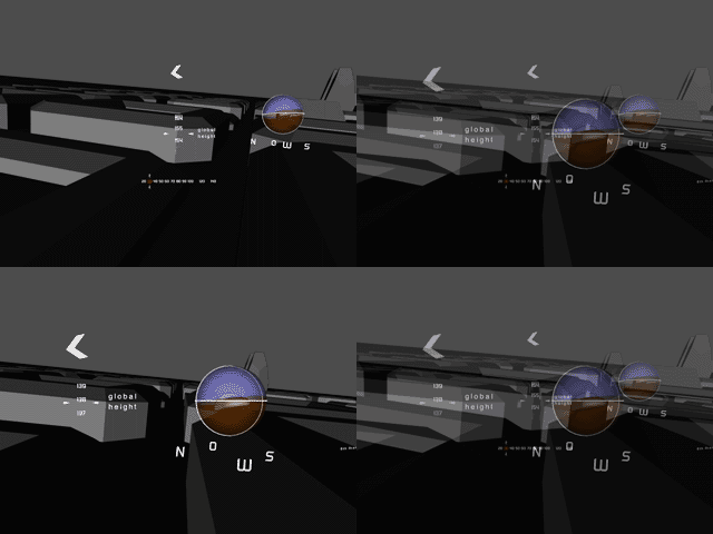 |
Flying behavior in the Blue Zones:
Three essential types of information are displayed:
The Aircar-Sphere with horizon and reference circles and a compass on
the right, the global altimeter in the center and the arrow on top give
sufficient information to show your position in space.
|
|
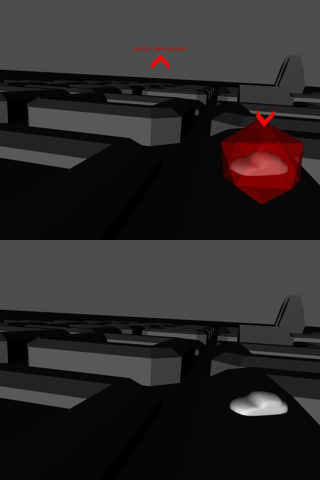
Collision-Avoidance System 1:
If two aircars get too close or about to collide, a a collision-avoidance
system redirects them. The Deviation-Indication shows the fact:
The pilot's aircar will be pushed upwards.
The oncoming aircar is shown in an edged shape.
|
|
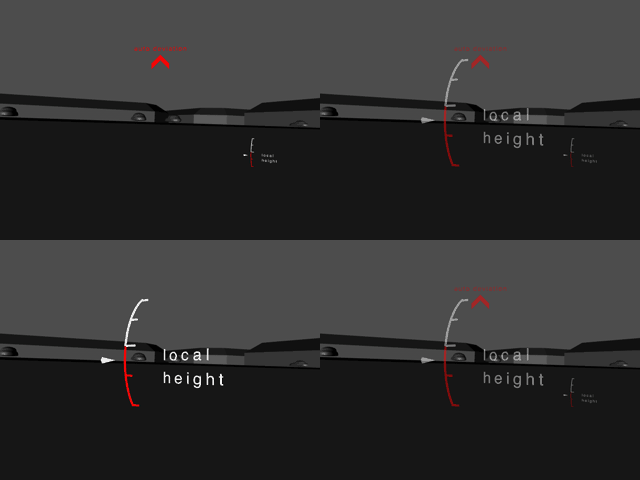
Collision-Avoidance System 2:
Flying too close to a building, the same system will be activated. The
local altimeter shows your relative height.
|
|
 last
updated 09/2006 last
updated 09/2006
|
mailto: Christian Frey @ www.freypark.com
|


