|
|
|
|
AIRWAYS AND SKYWAYSBackground The aim is to maximise the use of the "new" third spatial
axis (y).
The pilot chooses the path he/she wants to fly without the guidance of a virtual road system. In this approach the computer functions solely as a collision avoidance system.
As the "chaotic" approach does not derive from current social
mobility conventions, an ordered grid system offers a more practical
basis for future mobility. The grid based systemzeroG-Autobahn divides space into three substantial areas: a global,
regional and a local zone.
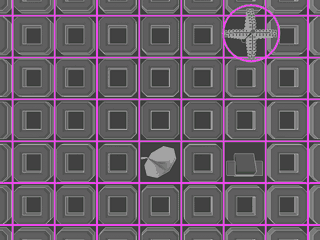
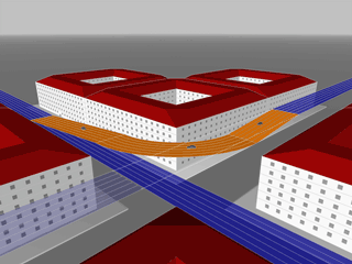
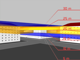
A regional road grid (the Airways) manages the busy traffic within highly populated areas. It arranges the diverse space between buildings in an efficient way.
The Skyway grid links cities and enitre regional areas. It allows high speed traveling for fast and convenient journeys.
Finally, the Blue Zones, organize local surroundings when drivers are approaching individual sights (examples). |
|
|
|
All individual areas are linked by virtual bridges (exits and entries) |
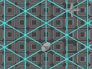
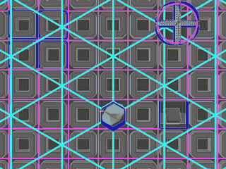
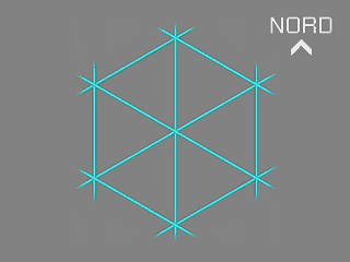
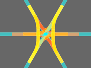
The Euro - Grid System : The SkywaysThe Skyway grid is based on equilateral triangles. Any Skyway layer consists of linked triangles with three directions, e.g. north-to-south, northeast-to-southwest and northwest-to-southeast. >>> Detail
|
Adapted to the current traffic situation, several Skyway or Airway layers can be stacked on top of each other. |
|
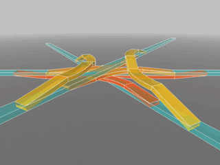
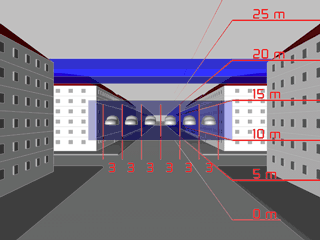
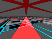
To avoid collision spots at the intersections and to optimize traffic flow, all streets, Airways and Skyways are placed in 10 meters height difference, offering the maximum efficiency in terms of continuity and connectivity.The colored junctions connect all directions.The yellow junctions connect the top lane with the botttom lane in one layer. The orange and red connectors are placed between the directions.
To change direction, the pilot exits his lane vertically,
flies the curve, and merges into the new direction from top or below,
making his way ahead aided by the real-time computer guidance system
displayed.
An Airway crossing between the buildings:
Junctions use the 10 meter space between the main directions: |
Skyway and Airway Junctions
|
|
|
mailto: Christian Frey @ www.freypark.com |